Europe heatwave satellite images collected this summer show the scale of damage wrought by successive extreme temperatures across western Europe, with rivers at historic lows, glaciers retreating and vast areas of vegetation turning brown.
Copernicus, the EU’s climate monitoring service, has confirmed that western Europe experienced its hottest June-to-July period on record. The heatwaves have been driven by persistent high-pressure weather systems, according to the Met Office, which says those systems bring clear skies and allow temperatures to build. Climate change, mainly caused by the burning of fossil fuels, has been raising average temperatures for decades and making such hot spells more likely and more intense.
Rivers at their lowest in decades
The Danube has dropped to its lowest levels for 30 years in several countries. The riverbed has yielded unusual discoveries, among them the bones of a mammoth in Bulgaria and a sunken Second World War warship in Serbia. Satellite imagery shows the wreck emerging clearly from the water.
The consequences have gone beyond the historical curiosities. Where the Danube passes through Hungary and Romania, nuclear power stations have been forced to shut down or run at reduced capacity because they cannot draw on river water for cooling. The Cernavodă plant in Romania, where two reactors produce about 20% of Romania’s electricity, is not expected to be restarted within the next 10 days, BBC News reported.
On the Rhine, some cargo vessels have been left stranded and river cruises have been cancelled as water levels fell.
Europe heatwave satellite images show Alpine glacier retreat
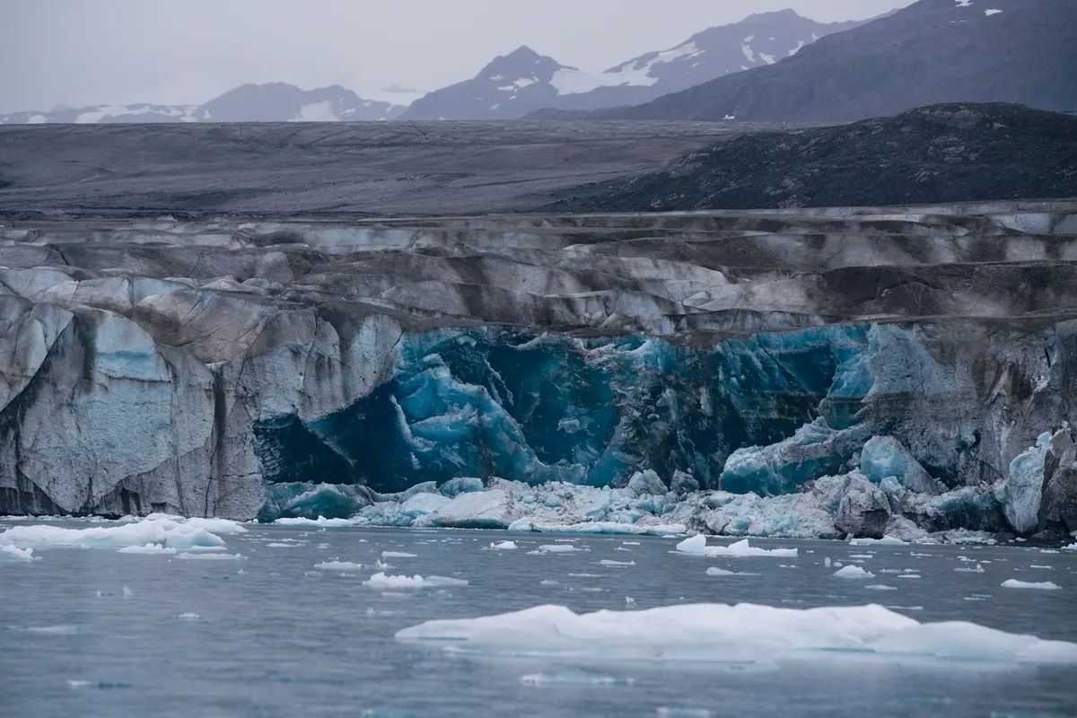
The Alps have not escaped the heat. Ongoing measurements suggest this summer could become one of the worst ever recorded for melting Alpine glaciers, with more than a month of the season still to go when that assessment was made.
A mild winter left glaciers with less snow cover than usual at the end of April. An unusually early heatwave the following month accelerated the melting of that snow, exposing the ice beneath and leaving glaciers vulnerable to faster melting in each subsequent heatwave. Satellite imagery suggests much of the front of Rhône Glacier in Switzerland has retreated by 50 metres or more since the same time last year.
Dr Lander van Tricht, a glaciologist at the Swiss Federal Institute of Technology, said climate change had led in recent years to ‘much less snow in winter and much, much more melt in summer’. He warned: ‘And if we continue this trend, then the future looks very dramatic for the Alps.’
Wildfires and vegetation stress
Wildfires have transformed large parts of western Europe this summer. More than 90,000 hectares have burned in France, already its worst year on record according to the European Forest Fire Information System. The largest fire in the Gironde region burned about 42,000 hectares, roughly the equivalent in size to the Isle of Wight.
Dr Douglas Kelley of the UK Centre for Ecology and Hydrology said extreme wildfires are becoming ‘more and more frequent’ as climate change creates ideal conditions, with higher temperatures drying out vegetation and soils faster.
The scale of vegetation stress is visible in satellite data. Using the Normalised Difference Vegetation Index, a measure of how green and healthy vegetation is, the readings this summer came in below a five-year benchmark across about 70% of France. Close to half the UK and roughly 40% of western Germany showed the same pattern.
Prof Andrew Challinor, from the University of Leeds, said the images were ‘consistent with widespread water stress’, which ‘does not bode well’ given that much of Europe’s land is covered by crops, meaning it could affect the agriculture industry and food production.
In the worst-affected areas, soil moisture is lower than on about 98% of comparable dates in the historical record, according to Prof Luis Samaniego, from the Helmholtz Centre for Environmental Research. He warned that even if rain returns, some of the agricultural damage may already have been done.
The Palace of Versailles, south of Paris, appears in satellite imagery as an island of trees surrounded by brown fields, a visual illustration of how far the effects of this summer’s heat have spread across the continent.